Joined: Thu May 19, 2005 3:45 pm
Posts: 3903
Location: NJ, USA
|
|
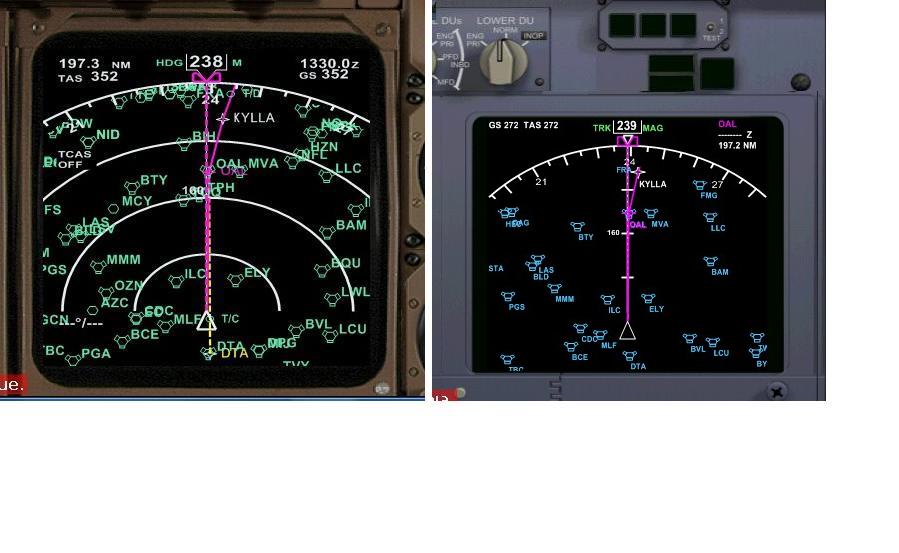
You're assumption is that the navaids display on the map is correct and
the displayed flight plan route is incorrect.
Actually its the reverse, the OAL on the flight plan route is in the
correct position, but the OAL on the PSS 777 nearby Navaids display is in the wrong position.
For reference see the same location as displayed in my ISG1 Nav display, and my PMDG 737NG below. OAL is approx heading 240 from that location which lines up correctly with the flight plan route displayed.
I suspect the issue is some sort of magnetic variation difference. The declination for that area is about 14.5 degrees.
Regards.
Ernie.
| Attachments: |
nd_test.jpg [ 63.58 KiB | Viewed 5916 times ]
|
|
|

